Property — Location & Phase-0 logger zones
LOCKED tax cites and EX-08-meta acres. Maps below are planning exhibits — not a survey.
Address & tax cite
| Address | 306 Bog Road, Gilead, ME 04217 (Oxford County) |
|---|---|
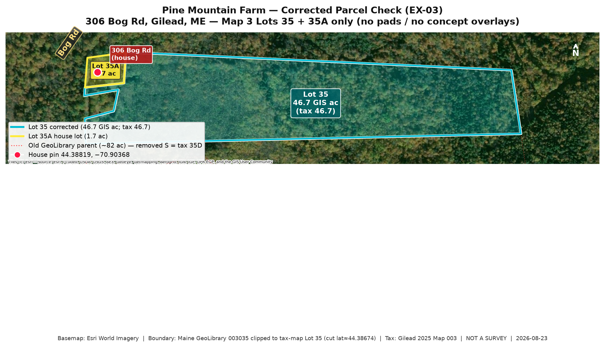
| Lot 35 | 46.7 acres (farm land) |
| Lot 35A | 1.7 acres (house / Bourbon House) |
| Combined | ≈ 48.4 assessor acres |
| Deed | Wigley → Michel Eric & Grace H. Chamberland, Book 5544 Page 855 (8/31/2020). Lost Corner Apr 2020 survey: 46.7 retained / 30.8 to Slattery. |
| GIS | Official tax-calibrated Lot 35 working outline (~46.71 geodesic). Mike KMZ retired. GeoLibrary ~82 ac parent polygon rejected. |
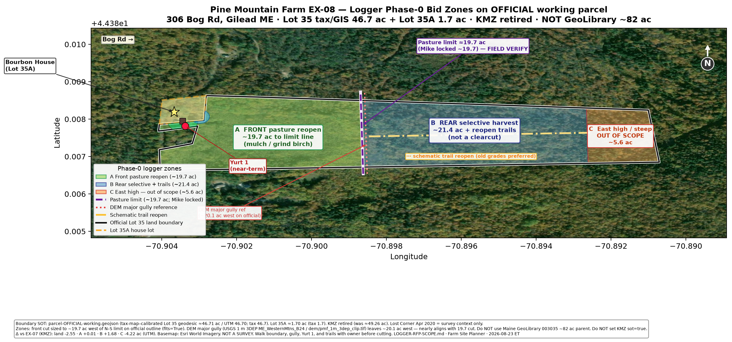
EX-08-meta logger Phase-0 zones
UTM on official outline; field-verify. Not a survey
| Zone A — Front pasture reopen | 19.67 ac — Mulch/grind birch for pasture |
|---|---|
| Zone B — Rear selective + trails | 21.45 ac — Selective harvest + trail reopen (not clearcut) |
| Zone C — East steep | 5.59 ac — OUT OF SCOPE this bid |
DEM gully west ≈20.1 ac — field-verify vs ~19.7 pasture lock. Maps from Farm Site Planner: EX-08 pack + robot-corridor walkthrough note.
KMZ retired. Do not treat retired KMZ exports as source of truth. Use the official footprint / EX-08 exhibit set.
Maps (planning exhibits)